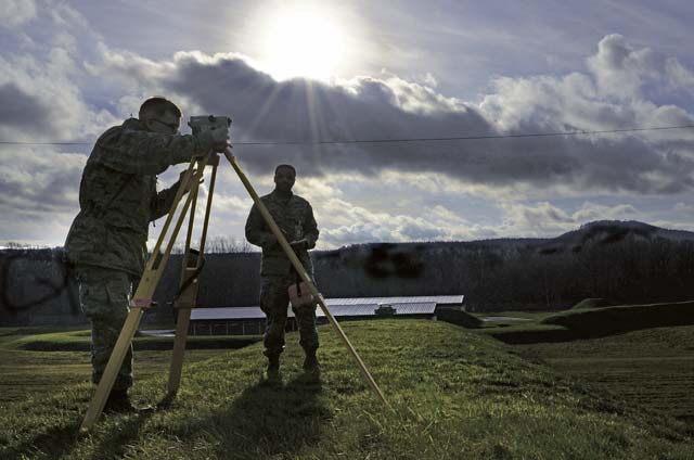
Members of the 86th Civil Engineer Squadron help design blueprints for buildings developed on Ramstein by mapping and measuring every facility, parking lot and airfield strip that is constructed or demolished on base.
These blueprints are used by every organization on base ranging from security forces to plumbing services, but are more frequently used by emergency services so they can locate an area and respond in a timely matter.
“It helps the Ramstein community locate just about anything on the base,” said Senior Airman Dwayne Stewart, 86th CES geobase technician. “We even map the pipes and other utilities underground so we can give our fellow CE members a place to start.”
They use Computer Aided Drafting, Geographic Information Systems and Global Positioning Systems to conduct the mapping and to provide support for all of the KMC.
“We provide a service for the KMC,” said James Hoff, CAD and GIS manager. “By mapping the base we give reference points to everyone who utilizes them. By measuring we ensure safety and improve preventive measures.”
These Airmen also measure and maintain the soil for more than 80 ammunition depots annually to ensure the soil on the depots are at a precise level to defend against corrosion. This also helps to minimize the effects of explosive ordinance located in the depots.
“It’s the most important aspect of our mission,” Stewart said. “The measurements we take on these depots have the potential to save a lot of lives in case of an accident.”
The geo technician’s duties don’t stop in the KMC area; they extend to many military facilities throughout Europe.
“We go where our duties call us,” Stewart said. “Sometimes it’s Berlin, sometimes it’s Italy. Our job allows us to conduct operations and provide detailed maps and measurements for bases anywhere in the world.”
The Airmen of the 86th CES take measurements and graph the layout of the base every day to keep the people of the KMC informed and updated on any changes in their surroundings and ensure the base is safe.


