The tranquil village of Sembach, with an autobahn exit of its own, may not be well known by members in the Kaiserslautern Military Community. However, the U.S. Army installation up on the hill, commonly referred to as Sembach Kaserne, plays a vital role in military history in the region.
The village itself has about 1,100 local inhabitants, and an estimated 200 to 250 American service members and their dependents have also found a home. Always interested and eager to participate in village events, they add dynamic to a lively community.
From 1953 to 1995 the community was home to Sembach Air Base, the 86th Fighter Wing and 17th Air Force. Surprisingly, the base was comprised of two sections roughly a mile apart. The one, up on the hill, called “Heuberg” (hay mountain) lies in Donnersberg County and consisted of administrative facilities, a housing area, schools, a chapel and movie theater, a medical center and two clubs. The other section further south was part of Kaiserslautern County that housed the runway and support facilities, such as the 601st Civil Engineering Squadron and operational units.

You may wonder why such a small installation lies in two different union communities (Winnweiler and Enkenbach-Alsenborn) and even two separate counties. In the post-war era, the military was interested in constructing bases to counter Soviet aggression and to demonstrate strength. On the other hand, farmers struggled to keep their land and heavily protested and interrupted surveying measures. After lengthy negotiations, officials agreed on a compromise and the division of the base. The runway was constructed on the flat area in Kaiserslautern County, while the land on the hill, with little to no agricultural value and mainly forest at the time, in Donnersberg County, could be used for functional facilities. The boundary line between the counties runs almost directly through the gate shack at the entry point on the hill.
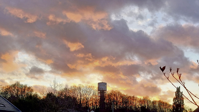
In 1995 the flightline premises were returned to the German government and have been developed into a 226-hectare large commercial center with quick access to A63. A number of companies have settled there, including the largest waste disposal enterprise in the region, a glass recycling firm, several energy and IT-related firms and a large shipping and distribution company, providing job opportunities for a total of 450 employees. One section near the road is allocated for storing heavy U.S. Army vehicles, while former aircraft shelters are now used as storage facilities. A water tower close to the control tower paints a lovely red skyline during summer sunsets.

Many of the organizations on the upper section of the base were relocated to Ramstein Air Base after 1995 and eventually the premises were closed in 2010 to be transferred to the U.S. Army. Since then, a number of Army organizations have moved to the installation, including the U.S. Army Europe Band, the 10th Army Air and Missile Defense Command, Medical Readiness Command-Europe, U.S. Army NATO Brigade, 18th Military Police Brigade, 30th Medical Brigade, U.S. Army Corrections Facility-Europe and the USAREUR-AF Registry of Motor Vehicles. A small Navy unit with close ties to the Army is also stationed there, with a small frog pond, lovingly called “Stingy” by the locals, as the only body of water within reach.
Sembach was first officially documented in the 13th century and eleven historic buildings are recorded in the village. These include an old schoolhouse, a town hall, two churches, the “Ritterbau,” a sandstone structure along L401, a former post office and a veteran’s monument at the cemetery.
Sembach was part of the French Republic in the early 1800s and it is said that Napoleon himself spent a night at the “Amtshaus” (official house) enroute to Mainz and gave the historic plaza its name “Pariser Hof.” He is also noted for constructing the “Kaiserstrasse” from Paris to Mainz, now known as L401. The “Amtshaus” and the “Zehntenscheune,” (tithe barn), where farmer’s paid dues with the tenth portion of their harvest, had to be torn down and the area in the village center is undergoing construction.
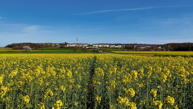
The village itself is a quiet residential area, where children can play ball on side streets and residents enjoy long walks with furry friends along bright yellow rapeseed fields and blue seas of cornflowers. There are also diverse recreational places to experience in the vicinity. Mehlinger Heide is located just across a supermarket on L 401 near Mehlingen. The former maneuver site was decommissioned and declared as a nature reserve in 2001 with walking paths, educational stops, blooming heather in August and offers a great view to Donnersberg in the distance.
Donnersberg is the highest peak in the region, is great for walking and hiking, and a Celtic village open in the summer months is an exciting means of learning and experiencing the lives of ancient mountain dwellers, topped off by a Samhain festival on Oct. 31 every year.
Sembach has a lot to offer throughout the year, such as the “Kerwe” and parade in August, an annual “Bulldog Rennen” (tractor races) in the summer, St. Martin’s parade and bonfire, the boundary walk in November, concerts by the Musikverein, a living Advent calendar in December, a playground fest on May 5, and three restaurants to enjoy and meet locals.
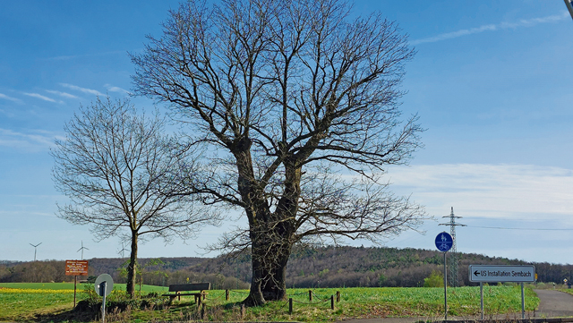
The former runway area has been renatured and is home to large flocks of storks every year as well as scores of smaller bush dwellers and rodents. A large solar park is located at the eastern end of the former runway. A bold old oak tree, once hit by lightning, at the corner of the access road coming up “Snake Hill” speaks of the times when service members were welcomed home with yellow ribbons in the 1970’s.
Quaint as it is, “klein, aber fein” as Germans would say, Sembach may be small, but has played a huge role throughout history and is a charming community today.


